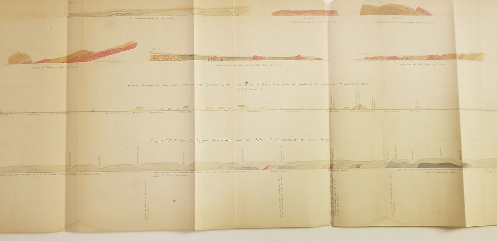
Beautiful 1852 hand-colored geological map with coast views and along the Pigeon River.
Outline of the Hills on Grand Portages of Pigeon River
Outline of the hills on Grand Portage of Pigeon River, North of Lake Superior: as seen from hill 650 feet high - 4 1/2 miles north of Grand Portage Bay. (with) Outline of the hills and ridges of the north shore of Lake Superior as seen from the top of the Great Palisade Rock. From an outline by J.G. Norwood. Engraved & printed by J.M. Butler.
1852. David Dale Owen, Report of a Geological Survey of Wisconsin, Iowa, and Minnesota and Incidentally of a Portion of Nebraska Territory.
J.M. Butler
12.25 x 33
Very good, 3 folds as issued
United States, West, Minnesota, Owen, Superior, Pigeon River, survey 1852
Unhappy with your product? Buyer's remorse? Return it to us undamaged within 15 days for a full refund.
All items ship FREE via USPS Media Mail. While this economical option can be slow at times, it includes tracking and typically delivery occurs within 10 days. If you prefer speedier delivery of your purchase, or for overseas addresses, we will calculate any additional charges.